

Graphing data for 5 locations on a single graph now available on WDFN
Official websites use .gov
A .gov website belongs to an official government organization in the
United States.
Secure .gov websites use HTTPS
A lock (
) or https:// means you’ve safely connected to the .gov website. Share
sensitive information only on official, secure websites.
Graphing data for 5 locations on a single graph now available on WDFN

A look into the current and coming soon features available in WDFN. Updated in 2025 to highlight progress and include links to new features

On October 13th 2022, we released a new water cycle diagram! This update re-envisions the water cycle, placing human activities at the forefront. We designed it to emphasize scientific accuracy, information design, and usability in educational settings. We hope that students of all ages better understand how humans affect where water is on Earth and how it moves, so that we can work towards using water more sustainably.
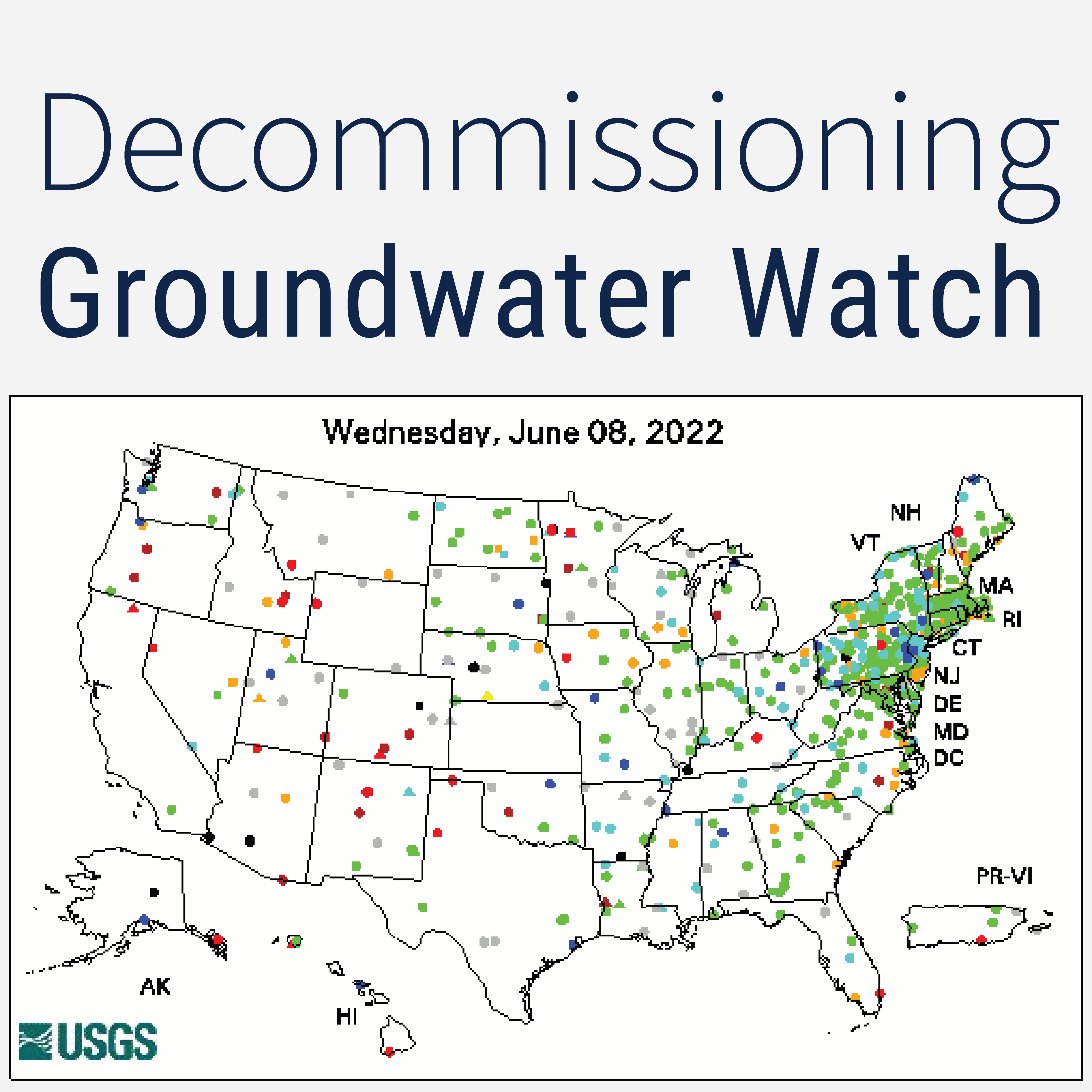
The legacy Groundwater Watch application is being decommissioned. This blog post explains where users can find similar functionality in other publicly available products.

Have you ever heard of user-centered design? We put our users first in how we design, update, and implement our water data delivery products.

We surveyed current Water Science School users about their experience. Thanks for sharing your feedback with us! Your participation ensures we will continue to meet user needs.

This posts explains the way we changed groundwater-level observations to the pre-2021 way of publishing observations.

USGS Water Data for the Nation products have many users. Check Status users want to quickly check the status of water data, and in order to do this, they have specific needs. Check Status users have a few favorite USGS products they use; read on to find out what they are.

